-
Table of Contents
“Revolutionizing Observation: The Future of Tech Innovations in Remote Sensing.”
Tech Innovations in Remote Sensing refers to the advancements and breakthroughs in the field of remote sensing technology. This technology involves the detection and monitoring of physical characteristics of an area by measuring its reflected and emitted radiation from a distance. Innovations in this field have led to the development of sophisticated tools and techniques that have significantly improved data collection and analysis. These advancements include the use of drones, satellites, and sensors for more accurate and efficient data gathering, as well as the application of artificial intelligence and machine learning for data processing and interpretation. These innovations have broadened the scope of remote sensing, making it a vital tool in various sectors such as agriculture, meteorology, geology, and environmental science.
Exploring the Latest Tech Innovations in Remote Sensing
Remote sensing, the science of obtaining information about objects or areas from a distance, typically from aircraft or satellites, has been revolutionized by recent technological advancements. These innovations have not only enhanced data collection and analysis but also expanded the application of remote sensing across various industries.
One of the most significant advancements in remote sensing technology is the development of high-resolution satellite imagery. This technology has dramatically improved the quality and detail of images captured from space, allowing for more precise and accurate data analysis. For instance, high-resolution satellite imagery can now provide detailed information about the earth’s surface, including vegetation, soil, and water bodies. This has proven invaluable in fields such as environmental monitoring, urban planning, and disaster management.
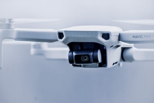
Another notable innovation in remote sensing is the use of drones or unmanned aerial vehicles (UAVs). Drones equipped with remote sensing technology can capture real-time data from areas that are difficult to access or hazardous. They can also cover large areas quickly, making them an efficient tool for data collection. For example, drones are now being used in agriculture to monitor crop health and detect pests or diseases early. This allows farmers to take timely action and improve crop yield.
The integration of artificial intelligence (AI) and machine learning (ML) with remote sensing is another groundbreaking development. AI and ML algorithms can analyze large volumes of remote sensing data quickly and accurately, identifying patterns and trends that may not be apparent to the human eye. This has significant implications for climate change research, where AI and ML can help predict future climate patterns based on historical data.
The advent of Internet of Things (IoT) in remote sensing has also opened up new possibilities. IoT devices equipped with sensors can collect and transmit data in real-time, enabling continuous monitoring and analysis. This is particularly useful in environmental monitoring, where IoT devices can track changes in air quality, temperature, humidity, and other environmental parameters over time.
The use of LiDAR (Light Detection and Ranging) technology in remote sensing has also seen significant advancements. LiDAR uses light in the form of a pulsed laser to measure distances. This technology can create high-resolution 3D maps of the earth’s surface, which are useful in fields such as forestry, geology, and archaeology.
In addition to these, the development of hyperspectral imaging in remote sensing has been a game-changer. Unlike traditional imaging techniques that capture images in a few broad spectral bands, hyperspectral imaging captures images in hundreds of narrow spectral bands. This allows for the identification of objects and materials based on their unique spectral signatures. Hyperspectral imaging has found applications in areas such as mineral exploration, environmental monitoring, and military surveillance.
In conclusion, the field of remote sensing has been transformed by technological innovations such as high-resolution satellite imagery, drones, AI and ML, IoT, LiDAR, and hyperspectral imaging. These advancements have not only improved the accuracy and efficiency of data collection and analysis but also expanded the application of remote sensing across various industries. As technology continues to evolve, we can expect to see even more exciting developments in remote sensing in the future.
How Tech Innovations are Revolutionizing Remote Sensing
Remote sensing, the science of obtaining information about objects or areas from a distance, typically from aircraft or satellites, has been a game-changer in numerous fields. From environmental monitoring to military surveillance, remote sensing has proven to be an invaluable tool. However, the advent of new technologies is revolutionizing this field, making it more accurate, efficient, and accessible.
One of the most significant tech innovations in remote sensing is the development of advanced sensors. These sensors are becoming increasingly sophisticated, capable of capturing high-resolution images and data from greater distances. For instance, Light Detection and Ranging (LiDAR) technology uses light in the form of a pulsed laser to measure variable distances to the Earth. This technology has been instrumental in creating high-resolution maps, 3D modelling of the Earth’s surface, and even in self-driving cars.
Moreover, the integration of Artificial Intelligence (AI) and Machine Learning (ML) with remote sensing has opened up new possibilities. AI and ML algorithms can analyze the vast amounts of data collected by remote sensors more quickly and accurately than ever before. This not only speeds up the data processing time but also improves the accuracy of the analysis. For example, AI can be used to identify specific features in satellite images, such as buildings, roads, or areas of deforestation. This can be particularly useful in disaster management, where rapid response is crucial.
In addition, the rise of small satellites, or smallsats, is another tech innovation that is transforming remote sensing. Smallsats are significantly cheaper to build and launch than traditional satellites. This has led to an increase in the number of satellites in orbit, providing more frequent data updates and better global coverage. Furthermore, smallsats often work in constellations, which allows for more detailed and comprehensive data collection.
The advent of cloud computing has also had a significant impact on remote sensing. Storing and processing data in the cloud allows for more efficient data management and easier access to information. This is particularly important given the vast amounts of data generated by remote sensing technologies. Cloud-based platforms also facilitate collaboration, as data can be easily shared and accessed by multiple users.
Finally, the development of user-friendly software and applications has made remote sensing data more accessible to non-experts. This democratization of data is enabling more people to benefit from remote sensing technology. For instance, Google Earth uses satellite imagery to provide detailed, accessible maps of the entire globe. Similarly, apps like NASA’s Worldview allow users to explore satellite data in near real-time.
In conclusion, tech innovations are revolutionizing remote sensing, making it more accurate, efficient, and accessible. Advanced sensors, AI and ML, smallsats, cloud computing, and user-friendly software are all contributing to this transformation. As these technologies continue to evolve, we can expect to see even more exciting developments in the field of remote sensing. Whether it’s monitoring climate change, managing natural disasters, or planning urban development, these innovations are helping us to understand and interact with our world in new and exciting ways.
The Impact of Emerging Technologies on Remote Sensing
Remote sensing, the science of obtaining information about objects or areas from a distance, typically from aircraft or satellites, has been revolutionized by the advent of emerging technologies. The impact of these technological innovations on remote sensing is profound, transforming the way we collect, analyze, and interpret data about our planet.
One of the most significant advancements in remote sensing technology is the development of high-resolution satellite imagery. This technology has dramatically improved the quality and detail of images captured from space, allowing for more accurate and detailed analysis of the Earth’s surface. High-resolution satellite imagery has been instrumental in various fields, including environmental monitoring, urban planning, and disaster management. For instance, it has enabled scientists to monitor deforestation and track the effects of climate change with unprecedented precision.
Another game-changing innovation in remote sensing is the use of drones or unmanned aerial vehicles (UAVs). Drones have the advantage of being able to fly at lower altitudes and in more diverse weather conditions than traditional aircraft, making them ideal for collecting high-resolution imagery and data. They are also more cost-effective and less risky, as they do not require a human pilot. Drones have been used in a wide range of applications, from mapping and surveying to wildlife monitoring and agricultural management.
Artificial intelligence (AI) and machine learning (ML) are also making significant strides in the field of remote sensing. These technologies are being used to automate the analysis of remote sensing data, making it faster and more efficient. AI and ML algorithms can identify patterns and trends in large datasets that would be impossible for humans to detect, leading to more accurate and insightful interpretations. For example, AI has been used to predict natural disasters such as floods and wildfires based on patterns in satellite imagery.
The Internet of Things (IoT) is another emerging technology that is impacting remote sensing. IoT devices, such as sensors and smart meters, can collect and transmit data in real-time, providing a continuous stream of information. This real-time data collection is particularly useful in environmental monitoring, where timely information is crucial for effective decision-making. For instance, IoT sensors can be used to monitor air quality or water levels in a particular area, providing real-time updates that can help mitigate environmental risks.
Lastly, cloud computing is playing a crucial role in the evolution of remote sensing. The vast amounts of data generated by remote sensing technologies require significant storage and processing power. Cloud computing provides a scalable and cost-effective solution for storing, processing, and analyzing this data. It also enables real-time access to data from anywhere in the world, facilitating collaboration and data sharing among researchers and organizations.
In conclusion, the impact of emerging technologies on remote sensing is transformative. High-resolution satellite imagery, drones, AI and ML, IoT, and cloud computing are not only enhancing the capabilities of remote sensing but also expanding its applications. These technological innovations are enabling us to understand and interact with our planet in ways that were previously unimaginable. As these technologies continue to evolve, we can expect to see even more exciting advancements in the field of remote sensing.
Understanding the Role of Tech Innovations in Advancing Remote Sensing
Remote sensing, a technology that allows us to gather information about objects or areas from a distance, has been a game-changer in various fields such as meteorology, geology, agriculture, and environmental science. The advent of tech innovations has significantly advanced remote sensing, enabling us to collect more precise and comprehensive data than ever before.
One of the most significant tech innovations in remote sensing is the development of high-resolution satellite imagery. This technology has revolutionized the way we monitor and understand our planet. High-resolution satellite imagery allows us to capture detailed images of the Earth’s surface, providing valuable data for various applications. For instance, in agriculture, farmers can use this data to monitor crop health and optimize irrigation. In environmental science, researchers can track changes in ecosystems and biodiversity over time.
Another groundbreaking tech innovation in remote sensing is the use of drones or unmanned aerial vehicles (UAVs). Drones equipped with remote sensing technology can capture high-resolution images and videos of the Earth’s surface. They can access areas that are difficult or dangerous for humans to reach, making them an invaluable tool for data collection. For example, drones are used in disaster management to assess damage and plan recovery efforts. They are also used in wildlife conservation to monitor animal populations and habitats.
Artificial Intelligence (AI) and Machine Learning (ML) are also playing a pivotal role in advancing remote sensing. These technologies can process and analyze large volumes of data collected through remote sensing, identifying patterns and trends that would be difficult for humans to detect. For instance, AI and ML can be used to predict weather patterns, monitor climate change, and even detect natural disasters before they occur.
The integration of Internet of Things (IoT) with remote sensing is another tech innovation that is enhancing data collection and analysis. IoT devices equipped with sensors can collect real-time data from the environment, which can then be analyzed using remote sensing technology. This integration allows for more accurate and timely data collection, which is crucial in fields such as meteorology and environmental science.
The advent of cloud computing has also significantly advanced remote sensing. Cloud computing allows for the storage and analysis of large volumes of data collected through remote sensing. This technology enables researchers and scientists to access and analyze data from anywhere in the world, making it easier to collaborate and share findings.
In conclusion, tech innovations are playing a crucial role in advancing remote sensing. High-resolution satellite imagery, drones, AI and ML, IoT, and cloud computing are just a few examples of the technologies that are revolutionizing this field. These innovations are enabling us to collect more precise and comprehensive data, enhancing our understanding of the world and helping us address some of the most pressing challenges of our time. As technology continues to evolve, we can expect to see even more advancements in remote sensing, opening up new possibilities for research and application.
Q&A
1. Question: What is remote sensing technology?
Answer: Remote sensing technology is a method of obtaining information about objects or areas from a distance, typically from aircraft or satellites. It involves detecting and measuring the physical characteristics of an area by recording reflected or emitted energy.
2. Question: What are some recent innovations in remote sensing technology?
Answer: Recent innovations in remote sensing technology include the development of hyperspectral imaging, which captures high-resolution images across the electromagnetic spectrum, and the use of drones for more localized data collection. Additionally, advancements in satellite technology have led to improved spatial, spectral, and temporal resolution.
3. Question: How is AI being used in remote sensing?
Answer: AI is being used in remote sensing to analyze and interpret the vast amounts of data collected. Machine learning algorithms can identify patterns and anomalies in the data, which can be used for applications such as predicting weather patterns, monitoring environmental changes, and detecting natural disasters.
4. Question: What is the future of remote sensing technology?
Answer: The future of remote sensing technology is likely to involve further integration with AI and machine learning for more sophisticated data analysis. We can also expect to see more use of unmanned aerial vehicles (UAVs) for data collection, and advancements in satellite technology that will provide even higher resolution images.In conclusion, tech innovations in remote sensing have revolutionized the way we collect and analyze data about the Earth and its atmosphere. These advancements have led to improved accuracy, efficiency, and speed in data collection, enabling more precise forecasting and decision-making in various fields such as meteorology, agriculture, environmental monitoring, and defense. The integration of AI and machine learning has further enhanced the capabilities of remote sensing technologies, paving the way for more sophisticated applications in the future. However, these innovations also pose new challenges in terms of data management, privacy, and security, which need to be addressed to fully harness their potential.